RF Frontend
A Quadrifilar Helix (QFH) antenna paired with a low-noise amplifier (LNA) and bandpass filter ensures high signal-to-noise ratio during low-elevation passes.
An advanced student-run ground station capturing meteorological and environmental data directly from NOAA, Meteor, and geostationary satellites as they pass overhead.
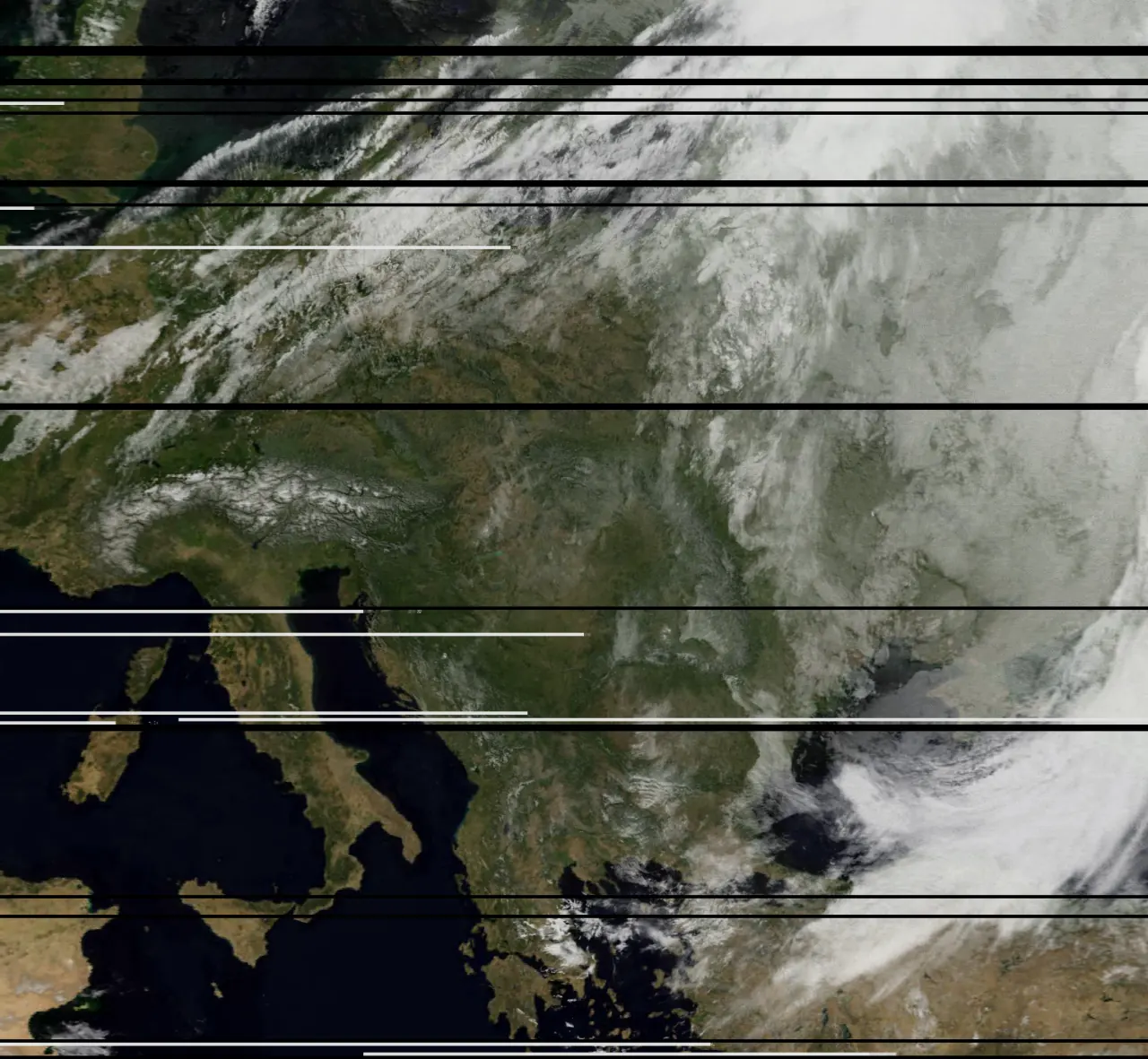
We process live signals from meteorological satellites to reconstruct high-resolution weather images and analyze planetary conditions.
A Quadrifilar Helix (QFH) antenna paired with a low-noise amplifier (LNA) and bandpass filter ensures high signal-to-noise ratio during low-elevation passes.
Signals received at 137 MHz are recorded, auto-doppler corrected, and demodulated into gray scales, then combined into false-color composite images.
Using a parabolic dish and custom feed, we track geostationary satellites to receive high-bandwidth data channels and full-disk planet imagery.
A dedicated terminal displayed in V LO Bielsko-Biała updates continuously as passes occur, providing students with live atmospheric insight.